Whether you're planning to build an extension, develop land, or simply need accurate information about your property, understanding topographic surveys is essential. My Topographic Surveyor UK has conducted thousands of topographical surveys across the UK, and in this comprehensive guide, we'll explain everything you need to know about topographic land surveys, from what they measure to how much they cost.
A topographic survey (also called a topographical survey or topo survey) is much more than just a map of your property. It's a detailed representation of your land showing every natural and man-made feature, elevation changes, and physical characteristic. For architects, property developers, and homeowners planning building work, a professional topographic survey provides the foundational data that makes successful projects possible.
What Exactly Is a Topographic Survey?
A topographic survey is a detailed mapping of land that shows both horizontal positions and vertical elevations of all features on a property. Unlike a simple boundary survey that just marks property lines, or a building survey that focuses on structures, a topographical survey captures the complete three-dimensional character of your land.
What Does a Topographic Survey Show?
When you commission a topographic survey from My Topographic Surveyor UK, our experienced land surveyors document and map all these features:
Natural Topographic Features:
- Contour lines: Showing elevation changes and land gradients
- Trees and vegetation: Including species, size, and canopy spread where required
- Watercourses: Streams, rivers, ponds, ditches, and drainage channels
- Rock outcrops: Natural stone formations and geological features
- Slopes and embankments: Changes in ground level and steep gradients
- Natural boundaries: Hedgerows, woodlands, and landscape features
Man-Made Topographic Features:
- Buildings and structures: Houses, sheds, garages, conservatories
- Boundary features: Fences, walls, gates, and property lines
- Hard surfaces: Driveways, paths, patios, parking areas
- Services: Manholes, inspection covers, drainage grates (surface level)
- Roads and access: Streets, lanes, tracks, and access points
- Street furniture: Lamp posts, telegraph poles, signage
- Garden features: Retaining walls, steps, decorative elements
Why Do You Need a Topographic Survey?
Topographic surveys are essential for many different purposes. Understanding when and why you need one helps you plan projects effectively and avoid costly mistakes.
Planning Applications
Local planning authorities typically require topographic survey drawings as part of planning applications. Whether you're planning a house extension, new build, or commercial development, planners need to see how your proposed work relates to existing land levels, drainage, trees, and neighboring properties. A detailed topographic survey provides this context.
Architectural Design
Architects need accurate topographic data to design buildings that work with the land, not against it. The survey shows ground levels, allowing architects to plan foundations, drainage, and access appropriately. Without accurate survey data, architectural designs may be impractical or expensive to construct.
For example, if an architect doesn't know your garden slopes 1.5 meters from front to back, they might design a level patio that requires expensive excavation or retaining walls. With accurate topographic survey drawings, they design efficiently from the start.
Land Development
Property developers rely on topographical surveys to assess site suitability, calculate earthwork volumes, plan drainage systems, and design site layouts. The topographic data shows constraints (steep slopes, existing trees, drainage courses) and opportunities (level building platforms, good access points).
Drainage and Flood Risk
Understanding how water flows across your land is crucial for drainage design and flood risk assessment. Topographic surveys show land gradients and natural drainage patterns. This data helps engineers design effective drainage systems and identify potential flooding issues before they become expensive problems.
Property Purchases
Savvy property buyers sometimes commission topographic surveys before purchasing, especially for building plots or properties where development is planned. The survey reveals issues that might not be obvious during viewings - steep gradients, poor drainage, tree preservation orders, or boundary disputes.
How Are Topographic Surveys Conducted?
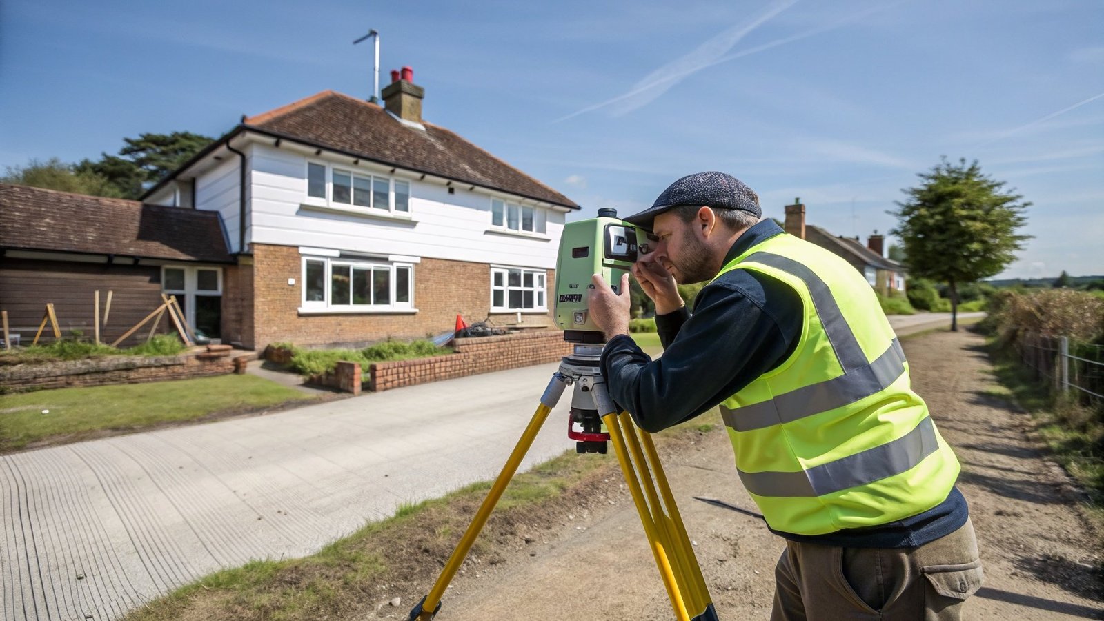
Modern topographic surveys combine advanced technology with traditional surveying expertise. At My Topographic Surveyor UK, our experienced surveyors use highly specialised survey equipment to capture accurate topographic data with millimeter precision.
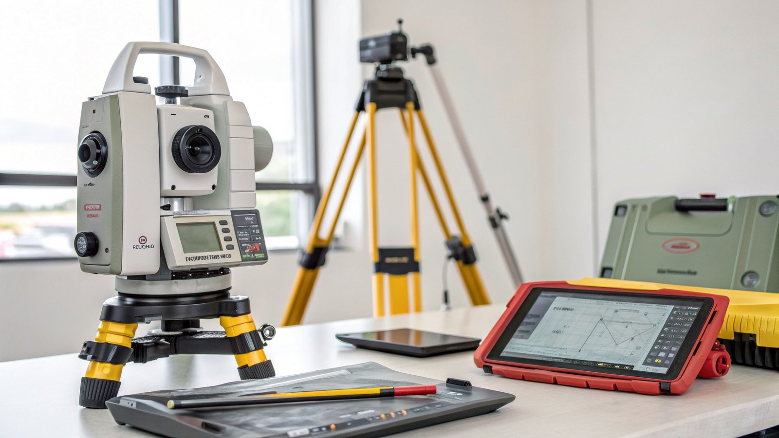
Survey Equipment Used
Total Stations
Total stations are the workhorses of topographic surveying. These electronic theodolites combine angle measurement with distance measurement using laser technology. Our surveyors set up total stations at known reference points and measure the position of every feature on your property. The equipment calculates exact three-dimensional coordinates for each measurement point.
GPS Technology
For larger sites, GPS (Global Positioning System) receivers provide rapid measurement of topographic features. Modern survey-grade GPS is accurate to within a few centimeters and allows experienced land surveyors to map large areas efficiently. GPS measurements are referenced to Ordnance Survey coordinates, making the survey data compatible with national mapping systems.
Laser Scanning
3D laser scanners capture millions of measurement points rapidly, creating detailed "point clouds" of complex sites. While more expensive, laser scanning is ideal for heritage buildings, complex topography, or when an extremely high level of detail is required. The technology produces comprehensive topographic data that can be processed into survey drawings or 3D models.
Digital Levels
For precise elevation measurements, digital levels provide accuracy to within millimeters. These instruments are particularly important when measuring subtle slopes for drainage design or when connecting survey data to existing benchmarks.
The Survey Process
Understanding what happens during a topographic survey helps you prepare and ensures you get the best results:
Step 1: Desktop Study
Before visiting your site, our experienced surveyors review available information including Ordnance Survey maps, aerial photography, Land Registry plans, and utility maps. This research identifies potential features to look for and helps plan the most efficient survey approach.
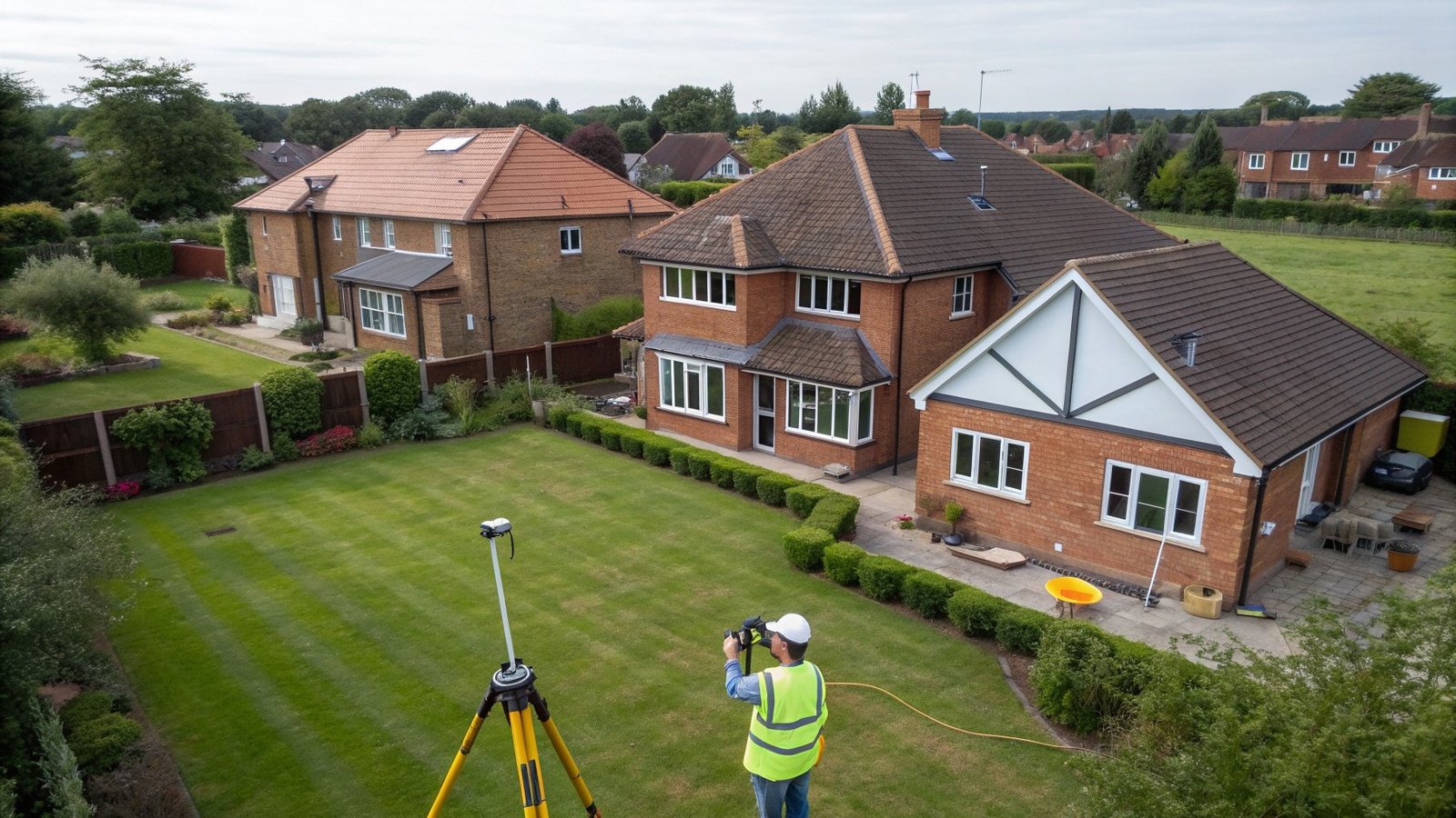
Step 2: Site Visit
Our surveyors arrive with professional survey equipment and establish a network of reference points around your property. They systematically measure every feature, taking hundreds or thousands of individual measurements depending on site complexity and the level of detail required.
The site visit typically takes a few hours for residential properties or several days for large commercial sites. During the survey, our experienced land surveyors photograph key features and take notes about site characteristics that aren't captured by measurements alone.
Step 3: Data Processing
Back in the office, surveyors process the raw survey data using specialized software. They create a digital model of your site, showing all measured features at their correct positions and elevations. This topographic data forms the basis of your survey drawings.
Step 4: Drawing Production
The processed data is converted into scaled survey drawings using Computer-Aided Design (CAD) software. Our topographic surveys are produced to client-specified standards, typically including:
- Site boundary clearly marked
- All buildings, structures, and boundary features
- Contour lines at specified intervals (typically 0.25m or 0.5m)
- Spot heights showing elevations at key points
- Trees and vegetation
- Surface water features and drainage
- Surface utilities (manholes, inspection covers)
- Hard surfaces and access ways
Step 5: Quality Control
Before delivery, experienced surveyors review all survey drawings for accuracy, completeness, and clarity. We check that survey specifications have been met and that the drawings clearly show all required information.
Understanding Survey Specifications and Level of Detail
Not all topographic surveys are created equal. The "level of detail" determines how much information is captured and affects both the survey cost and suitability for different purposes.
Standard Topographic Survey
A standard land survey captures all visible features with contours at 0.5 meter intervals. This level of detail suits most residential extensions, garden landscaping, and general planning applications. It's the most cost-effective option for typical projects.
Detailed Topographic Survey
Detailed surveys use finer contour intervals (0.25 meters or less) and capture more feature detail. Architects working on complex designs or engineers planning precise drainage systems often require this higher level of detail. The survey cost is higher due to more field measurements and processing time.
Measured Survey
A measured survey focuses primarily on buildings rather than land. While topographic surveys emphasize terrain, measured surveys provide detailed floor plans, elevations, and sections of existing structures. Many projects require both types - a topographic survey of the site plus a measured survey of buildings.
What Do You Receive?
When you commission a topographic survey from My Topographic Surveyor UK, you receive comprehensive deliverables designed for professional use:
Survey Drawings
Your main deliverable is a set of scaled survey drawings in CAD format (typically DWG or DXF files) and PDF format. These drawings show your complete site with all measured features clearly labeled. The survey is georeferenced to Ordnance Survey coordinates, allowing it to be overlaid with other mapping data.
Digital Elevation Model
For projects requiring detailed terrain analysis, we can provide a digital elevation model (DEM) showing ground levels as a continuous surface. This topographic data is useful for drainage analysis, volume calculations, and 3D visualization.
Survey Report
We provide a written report explaining survey methods, accuracy standards, reference points used, and any limitations. This documentation is important for professional users and may be required for planning applications or engineering calculations.

How Much Does a Topographic Survey Cost?
Land survey cost varies significantly based on multiple factors. Understanding these helps you budget appropriately and appreciate why quotes differ between surveyors.
Factors Affecting Survey Cost
Site Size
Larger sites take longer to survey, requiring more measurements and processing time. A small residential garden might take a few hours to survey, while a 10-acre development site could require several days of fieldwork. Survey cost scales roughly with area of land.
Site Complexity
Dense vegetation, steep terrain, restricted access, or numerous features all increase survey time. A flat, open site is quicker to survey than heavily wooded hillside. This complexity affects the land survey cost even for similar-sized properties.
Level of Detail
Higher detail requirements mean more measurements and finer contour intervals. A standard topographic survey with 0.5m contours costs less than a detailed survey with 0.25m contours. Specify the level of detail your architect or engineer actually needs to avoid paying for unnecessary precision.
Survey Specifications
Different users have different requirements. A planning application might need a basic topographic survey, while structural engineering may require precise building levels to 1mm accuracy. Clear survey specifications from the start ensure you get what you need at appropriate cost.
Location
Travel time and local costs vary across the UK. Experienced surveyors situated across the UK can provide more competitive land survey cost than surveyors traveling long distances. My Topographic Surveyor UK's national network minimizes travel costs.
Typical Topographic Survey Costs
While every site is unique, these ranges provide guidance:
- Small residential garden (100-300m²): £400-£700
- Standard house plot (300-1000m²): £600-£1,200
- Large residential site (1000-2000m²): £1,000-£2,000
- Small commercial site (2000-5000m²): £1,500-£3,500
- Development site (0.5-2 hectares): £3,000-£8,000
- Large development (2+ hectares): £8,000+ (quote required)
These are indicative costs for standard surveys. Complex sites, difficult access, or detailed specifications increase cost. My Topographic Surveyor UK provides free quotes tailored to your specific requirements.
Choosing the Right Surveyor
The quality of your topographic survey depends entirely on the surveyor's expertise and equipment. Don't make your decision based solely on survey cost - the cheapest quote often comes from inexperienced operators using inferior equipment.
Check Professional Accreditation
Reputable surveyors hold membership in professional bodies like RICS (Royal Institution of Chartered Surveyors), CIOB (Chartered Institute of Building), or RPSA. These accreditations demonstrate technical competence, professional standards, and appropriate insurance. My Topographic Surveyor UK's experienced surveyors are accredited under RICS, CIOB, and RPSA.
Verify Insurance
Professional land surveyors carry professional indemnity insurance covering errors in survey work. This protects you if survey inaccuracies cause design problems or additional costs. Always verify insurance before commissioning surveys for important projects.
Ask About Equipment
Modern, calibrated survey equipment is essential for accurate topographic surveys. Ask what equipment surveyors use - total stations, GPS systems, and laser scanners should be current models, regularly calibrated. My Topographic Surveyor UK invests heavily in highly specialised survey equipment to deliver the most accurate topographic data.
Review Sample Work
Ask to see examples of survey drawings. Professional topographic surveys should be clear, well-labeled, and properly scaled. Poor drafting or confusing drawings suggest inexperience even if measurements are accurate.
Check Coverage
Experienced land surveyors situated across the UK provide faster service and lower travel costs than surveyors covering vast territories from a single base. My Topographic Surveyor UK's national network ensures prompt service across the whole of the UK.
Common Questions About Topographic Surveys
How Long Does a Topographic Survey Take?
The survey process typically takes 1-2 weeks from instruction to delivery. Site visits for residential properties usually take 2-6 hours, with data processing and drawing production taking 3-7 working days. Rush services are available for urgent projects, though this affects land survey cost.
Do I Need to Be Present During the Survey?
Access to the property is essential, but your presence isn't required throughout. Brief the surveyors at the start about any specific requirements, then they can work independently. They'll contact you if questions arise about boundary features or access to particular areas.
What If My Land Isn't Registered?
Unregistered land is common, particularly for older properties or rural estates. Topographic surveys don't require Land Registry documentation, though surveyors may reference historic deeds or Ordnance Survey maps to establish context. Many owners use topographic surveys as part of first registration with Land Registry.
Can Surveys Be Done in Winter?
Yes, experienced land surveyors work year-round across the UK. Snow can temporarily prevent surveying, and dense vegetation is harder to survey through, but most conditions don't significantly affect modern survey equipment. Summer's lush vegetation actually makes some sites harder to survey than winter's bare ground.
How Accurate Are Topographic Surveys?
Professional topographic surveys using total stations and GPS achieve accuracy of ±5-10mm for measured points. Contour accuracy depends on point density and terrain complexity, typically ±25mm for detailed surveys. This precision far exceeds the requirements of most planning and design applications.
What About Underground Utilities?
Standard topographic surveys only show surface features. For underground utilities (pipes, cables, ducts), you need a separate utility survey using ground-penetrating radar and electromagnetic detection. My Topographic Surveyor UK offers utility surveys as an additional service that's essential before excavation work.
Using Your Topographic Survey
Once you receive your topographic survey, it becomes a valuable tool for multiple purposes:
For Architects
Provide your architect with the CAD files. They'll use the topographic data as the base layer for their designs, ensuring proposed buildings relate correctly to existing ground levels, boundaries, and features. Architects rely on accurate survey data - poor surveys cause design problems and construction issues.
For Engineers
Civil and structural engineers use topographic surveys for drainage design, earthwork calculations, foundation design, and structural assessments. The survey data shows where ground levels allow gravity drainage versus where pumped systems are needed.
For Planning Applications
Include survey drawings with your planning application. Planners use the topographic data to understand how proposals relate to the site and surroundings. Many authorities reject applications with poor or missing survey information.
For Landscaping
Landscape architects use topographic surveys to design gardens that work with natural contours. The survey shows drainage patterns, tree locations, and level changes - essential information for creating beautiful, functional landscapes.
Conclusion
Topographic surveys are fundamental to successful property development, planning applications, and architectural design. They provide the accurate topographic data professionals need to create appropriate, cost-effective designs that work with your land rather than fighting against it.
My Topographic Surveyor UK's experienced land surveyors combine advanced survey equipment with professional expertise to deliver accurate topographic surveys across the whole of the UK. Whether you need a simple residential topo survey or a complex commercial topographical land survey, our RICS, CIOB, and RPSA accredited team provides the quality and service you deserve.
Don't start your project without accurate survey data. Poor or missing topographic surveys cause design problems, planning delays, construction difficulties, and unexpected costs. Investment in a professional topographic survey at the project start saves money and prevents problems throughout design and construction.
Contact My Topographic Surveyor UK today for your free quote. Our friendly team explains exactly what survey you need, provides transparent land survey cost information, and schedules your survey promptly. With experienced surveyors situated across the UK, we provide fast local service wherever your property is located.
Ready for Your Topographic Survey?
Get an accurate quote from experienced RICS-accredited surveyors. Fast turnaround, professional service, competitive pricing.
Get Free Quote Learn More About Our Services