Hitting buried cables or pipes during construction is one of the most expensive and dangerous mistakes contractors face. My Topographic Surveyor UK has mapped underground services for thousands of construction projects across the United Kingdom, preventing costly utility strikes and keeping workers safe. In this comprehensive guide, we'll explain why utility surveys using ground penetrating radar and electromagnetic location are essential before any excavation work.
Whether you're planning a house extension, installing drainage, laying foundations, or managing commercial development, understanding what's buried beneath your site is critical. Utility surveys provide the accurate underground service mapping that meets CDM (Construction Design and Management) regulations and protects your project from disasters that can cost tens or hundreds of thousands of pounds.
What Are Utility Surveys and Why Are They Critical?
A utility survey (also called underground service detection or utility mapping) uses specialized equipment including ground penetrating radar (GPR) and electromagnetic location to detect and map buried services before construction or excavation begins. My Topographic Surveyor UK's experienced surveyors locate:
- Electricity cables: Underground power lines serving properties and street lighting
- Gas pipes: Mains gas supply pipes, often metal or plastic
- Water mains: Potable water supply pipes in various materials
- Drainage systems: Foul drainage, surface water, and combined sewers
- Telecommunications: Phone lines, fiber optic cables, and data services
- Historical services: Abandoned pipes and cables that still pose risks
Utility surveys prevent catastrophic failures including gas explosions, electrocution, water main bursts, and telecommunications outages that halt construction, endanger lives, and cost project owners enormous sums in damages, repairs, and legal liability.
The Real Cost of Utility Strikes
Property developers and homeowners who skip utility surveys face devastating consequences when excavators strike buried services. My Topographic Surveyor UK has been called to sites after utility strikes, and we've witnessed the financial and safety impacts firsthand.
Direct Costs of Hitting Underground Services
- Electricity strikes: £20,000-£100,000+ for cable replacement, emergency attendance, and business interruption
- Gas main strikes: £50,000-£250,000+ including evacuation costs, emergency services, and supply restoration
- Water main strikes: £10,000-£75,000 for repairs, water loss, and property damage from flooding
- Telecoms strikes: £15,000-£100,000 plus claims from businesses losing connectivity
- Construction delays: Weeks or months while utility companies repair damage
- Legal liability: Criminal prosecution under CDM regulations for failing to identify services
In comparison, commissioning professional utility surveys from experienced land surveyors using ground penetrating radar costs just £400-£2,500 for typical projects - a fraction of potential strike costs.
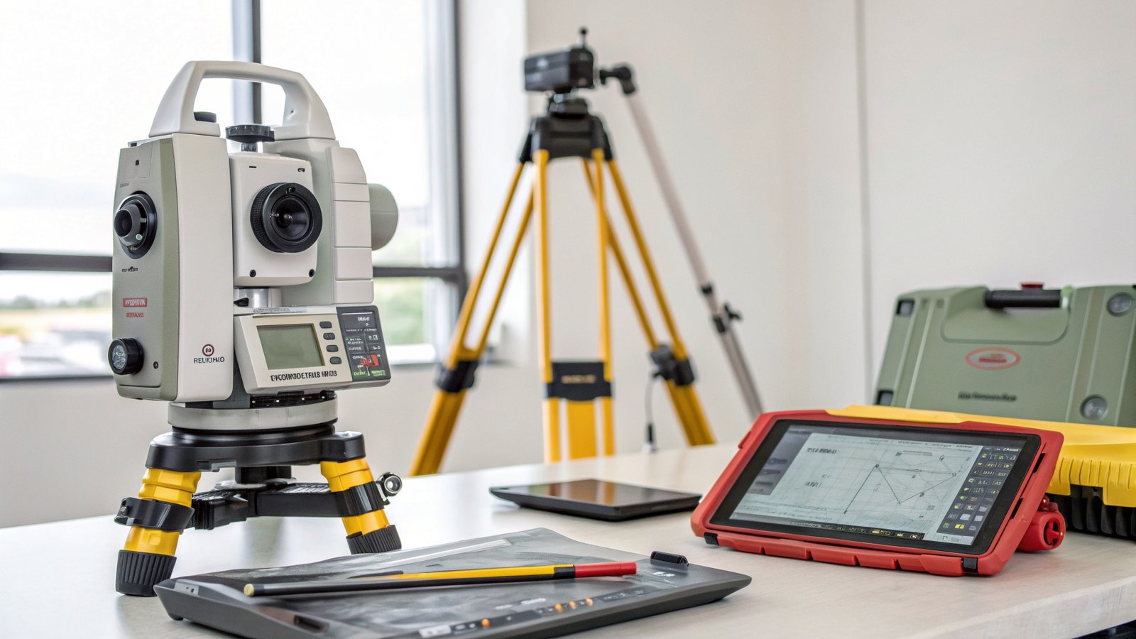
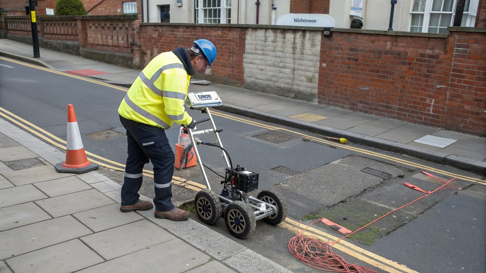
How Utility Surveys Work: Detection Technology Explained
My Topographic Surveyor UK uses multiple detection technologies because different underground services respond to different survey methods. Our experienced surveyors combine techniques for comprehensive utility mapping.
Ground Penetrating Radar (GPR)
Ground penetrating radar is the most powerful utility detection method. GPR equipment sends electromagnetic pulses into the ground and analyzes the reflected signals. When radar waves encounter buried pipes, cables, or voids, they reflect differently than surrounding soil.
What GPR detects:
- Plastic and non-metallic pipes that other methods miss
- Concrete structures and foundations
- Voids and cavities beneath surfaces
- Depth of buried services accurately
- Abandoned or non-functioning utilities
Ground penetrating radar works through concrete, tarmac, and soil, making it ideal for built-up areas where services are buried under hard surfaces.
Electromagnetic Location (EML)
Electromagnetic location detects metallic utilities by generating electromagnetic fields that induce signals in buried metal pipes and cables. Our experienced surveyors use specialized receivers to detect these signals.
What EML excels at detecting:
- Metal gas pipes and water mains
- Electricity cables with metallic sheaths
- Metal drainage pipes and culverts
- Reinforcement in concrete structures
EML is fast and effective for metallic services but can't detect plastic pipes, making it complementary to ground penetrating radar rather than a replacement.
Signal Tracing
For accessible services like manholes or meter boxes, our land surveyors use signal tracing. We apply a temporary signal to known service points and trace the signal path underground using specialized receivers.
Signal tracing provides highly accurate routes for electricity cables, telecom lines, and metal pipes that are accessible at service entry points.
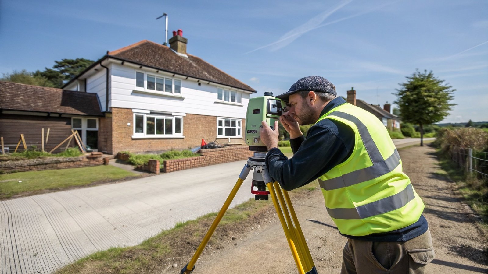
The Utility Survey Process
Understanding what happens during a utility survey helps property owners and contractors plan construction projects effectively. My Topographic Surveyor UK follows a systematic process that ensures comprehensive underground service mapping.
Step 1: Desktop Study
Before visiting your site, our experienced surveyors obtain utility records from service providers:
- Electricity distribution network operators
- Gas distribution networks
- Water companies
- Telecommunications providers
- Local authority drainage records
These records show approximate locations of mains supplies but are often incomplete or inaccurate. They provide starting points but can't replace on-site detection using ground penetrating radar and electromagnetic location.
Step 2: Site Survey
Our experienced land surveyors visit with professional utility detection equipment including ground penetrating radar and electromagnetic locators. We systematically scan the construction area, marking detected services with temporary paint or flags.
The site survey typically takes 4-8 hours for residential projects or 1-3 days for commercial sites, depending on area size and complexity.
Step 3: Survey Processing and Mapping
After fieldwork, we process ground penetrating radar data and create utility survey drawings showing:
- Positions of detected underground services
- Depths of buried utilities
- Service types (electric, gas, water, telecom, drainage)
- Confidence levels (detected, inferred, or speculative)
- Coordinates referenced to your site survey
Step 4: Reporting and Recommendations
My Topographic Surveyor UK provides comprehensive utility survey reports including:
- CAD drawings overlaid on topographic surveys
- Written descriptions of detected services
- Risk assessment for excavation work
- Recommendations for safe working practices
- Photographs of detection equipment findings
CDM Regulations and Utility Survey Requirements
The Construction Design and Management (CDM) Regulations 2015 place legal duties on project owners, designers, and contractors to identify and manage risks including underground services. Commissioning utility surveys is essential for CDM compliance.
Legal Obligations Under CDM Regulations
Clients (Property Owners and Developers) must:
- Provide pre-construction information including utility locations
- Ensure reasonable steps are taken to detect underground services
- Allocate sufficient time and budget for utility surveys
Designers (Architects and Engineers) must:
- Consider underground services in design work
- Eliminate or reduce excavation risks where possible
- Provide information about utility locations to contractors
Principal Contractors must:
- Plan construction work to avoid utility strikes
- Implement safe systems of work for excavations
- Provide workers with utility survey information
- Use appropriate detection methods before digging
Failure to comply with CDM utility survey requirements can result in criminal prosecution, unlimited fines, and imprisonment for serious breaches. My Topographic Surveyor UK provides utility surveys that meet CDM obligations and protect everyone involved in construction projects.
When You Need Utility Surveys
Property owners, developers, and contractors commission utility surveys from My Topographic Surveyor UK for numerous situations. Understanding when utility detection is essential helps you plan projects safely.
Residential Construction Requiring Utility Surveys
- House extensions: Foundation excavations near existing services
- Drainage installations: Trenches for new foul or surface water drainage
- Garden landscaping: Excavations for patios, decking, or garden features
- Driveway work: Installing new driveways or widening existing access
- Swimming pools: Deep excavations often encounter multiple buried services
- Outbuildings: Garden rooms, garages, or workshops requiring foundations
Commercial Projects Requiring Utility Mapping
- New build developments: Entire sites must be surveyed before earthworks begin
- Infrastructure projects: Roads, utilities, or public realm work
- Industrial sites: Factories, warehouses, or logistics facilities
- Retail developments: Shopping centers or commercial premises
- Renewable energy: Solar farms, wind turbines, or ground source heat pumps
Limitations of Utility Surveys
Experienced land surveyors like those at My Topographic Surveyor UK are honest about what utility detection can and cannot achieve. Understanding limitations helps you use survey data appropriately.
What Utility Surveys Cannot Guarantee
- 100% detection certainty: Ground penetrating radar and electromagnetic location are highly effective but can't detect everything in all ground conditions
- Plastic water pipes: Non-metallic services in certain soils may be difficult to detect
- Very deep services: Ground penetrating radar has depth limitations (typically 3-5 meters)
- Exact depths: Depth estimates from electromagnetic location have accuracy limitations
- Service status: Surveys can't definitively determine if detected utilities are live or abandoned
Despite these limitations, professional utility surveys from experienced surveyors using ground penetrating radar dramatically reduce utility strike risks compared to working without survey data.
Best Practices for Safe Excavation
My Topographic Surveyor UK recommends these safety practices when working near underground services, even after comprehensive utility surveys.
Safe Digging Procedures
- Hand dig near services: Use hand tools within 0.5 meters of detected utilities
- Use cable avoidance tools: Re-scan immediately before each excavation
- Expose services carefully: Verify utility positions before machine excavation
- Mark exposed services: Clearly identify services once exposed
- Support exposed utilities: Provide proper support for exposed pipes and cables
- Document as-built positions: Record actual service locations for future reference
FAQs: Utility Surveys and Underground Services
How accurate are utility surveys?
My Topographic Surveyor UK uses professional ground penetrating radar and electromagnetic location equipment that typically provides positional accuracy of ±100-300mm horizontally and depth accuracy of ±10-15%. Accuracy depends on ground conditions, service depth, and detection method. Our experienced surveyors classify detections by confidence level (detected, inferred, or speculative) so you know reliability of each finding.
Can utility surveys detect plastic pipes?
Yes, ground penetrating radar can detect plastic water pipes, drainage, and gas pipes. Plastic services create detectable contrasts in GPR data due to differences between pipe material and surrounding soil. However, plastic pipes are harder to detect than metal services, especially in certain soil types or at depth. This is why My Topographic Surveyor UK uses multiple detection methods for comprehensive utility mapping.
How much do utility surveys cost?
Utility survey costs for residential properties typically range from £400-£1,200 depending on site size and complexity. Commercial sites cost £1,000-£10,000+ reflecting larger areas and greater service complexity. Given that utility strikes cost £20,000-£250,000+, professional utility surveys are essential insurance against catastrophic failures.
How long does a utility survey take?
Site work for residential utility surveys typically takes 4-8 hours. Survey processing and report delivery takes 5-10 working days for standard projects. My Topographic Surveyor UK offers expedited services for urgent construction projects. Total turnaround from booking to receiving utility survey drawings is usually 7-14 days.
Are utility surveys legally required?
While not explicitly mandated by law, CDM Regulations 2015 require "reasonable steps" to identify underground services before excavation. Failure to commission utility surveys when striking services causes injury or damage constitutes CDM non-compliance, leading to prosecution. Most construction insurance policies also require evidence that utility detection was conducted before covering strike claims.
Can I excavate based on utility company records alone?
No - utility company records are notoriously inaccurate. Records show approximate locations based on as-built drawings from decades ago, often with positional errors of several meters. Services may have been added, diverted, or abandoned without record updates. My Topographic Surveyor UK always conducts on-site detection using ground penetrating radar and electromagnetic location rather than relying on records.
What happens if services are found where I need to build?
If utility surveys reveal services conflicting with your construction plans, you have several options: redesign to avoid services, arrange for utility companies to divert services (typically £5,000-£50,000), or implement protective measures like concrete encasement. Our experienced land surveyors provide recommendations for managing detected utilities safely and economically.
Why Choose My Topographic Surveyor UK for Utility Surveys
My Topographic Surveyor UK provides professional utility detection services using the latest ground penetrating radar and electromagnetic location equipment operated by experienced land surveyors across the United Kingdom.
- Advanced equipment: Professional ground penetrating radar and electromagnetic locators
- Multiple detection methods: We combine techniques for comprehensive utility mapping
- Experienced surveyors: Trained utility detection specialists with thousands of projects completed
- CDM compliant: Reports that satisfy Construction Design and Management requirements
- Fast turnaround: Standard 7-14 day delivery with expedited options available
- Nationwide coverage: Service across England, Scotland, Wales, and Northern Ireland
- Competitive pricing: Professional utility surveys that cost far less than potential utility strikes
Don't gamble with underground services. Before any excavation, trenching, or foundation work, commission a professional utility survey from My Topographic Surveyor UK. Our experienced surveyors using ground penetrating radar and electromagnetic location will map underground services accurately, keeping your project safe, on schedule, and within budget.
Protect Your Project with Professional Utility Detection
Contact My Topographic Surveyor UK today for a free utility survey quote. Our experienced land surveyors provide comprehensive underground service mapping using ground penetrating radar that prevents costly utility strikes and meets CDM regulations.
Request Free Utility Survey Quote