
Buying a property is likely the biggest financial investment you'll ever make. My Topographic Surveyor UK has worked with thousands of property buyers across the United Kingdom, and we've seen firsthand how a professional topographic survey can save buyers from expensive surprises after completion. While most buyers focus on building surveys and valuations, smart property purchasers commission topographic land surveys to understand exactly what they're buying.
In this guide, we'll explain why experienced property buyers include topographic surveys in their due diligence, what issues these surveys can reveal, and how survey data protects your investment long after you've moved in.
What Property Buyers Discover Through Topographic Surveys
My Topographic Surveyor UK conducts topographic surveys for property buyers that reveal critical information not covered by standard building surveys or homebuyer reports. While a building survey examines the structure, a topographical survey examines the land, boundaries, and external features that define your property.
Boundary Issues and Property Lines
One of the most valuable aspects of a topographic survey for property buyers is accurate boundary measurement. Unlike the general boundary lines shown on Land Registry plans, our experienced surveyors use laser equipment to precisely measure where boundaries actually are.
We regularly discover discrepancies that buyers would never spot during property viewings:
- Encroachment: Neighboring buildings, fences, or gardens extending onto the property you're buying
- Disputed boundaries: Fence lines that don't match legal boundaries shown on title deeds
- Access rights: Shared driveways or pathways that cross property boundaries
- Boundary features: Walls or hedges in poor condition that you'll become responsible for maintaining
- Missing boundaries: Areas where no physical boundary exists, leaving property lines undefined
Discovering these boundary issues through a topographic survey before completion gives you negotiating power. You can request the seller resolves problems, adjust your offer price, or decide not to proceed if issues are serious.
Drainage and Flood Risk Assessment
Understanding how water behaves on your potential property is crucial, yet most buyers overlook this until problems emerge after purchase. My Topographic Surveyor UK's topographical surveys reveal drainage patterns that can indicate flood risk or drainage problems.
What Topographic Data Shows About Drainage
Our experienced land surveyors map ground levels and contours that show you:
- Natural water flow: Which direction rainwater runs across the property
- Low-lying areas: Parts of the property where water collects or puddles
- Drainage systems: Location of manholes, drains, and surface water outlets
- Slopes toward buildings: Ground that slopes toward the house, potentially causing damp issues
- Neighboring drainage: Whether water from adjacent properties flows onto your land
One buyer we worked with in Lancashire discovered through our topographic survey that their potential property was at the bottom of a slope, with water naturally flowing from three neighboring gardens directly toward the house. The survey revealed inadequate drainage, explaining why the property had recurring damp issues that weren't apparent during dry-weather viewings.
Development Potential and Planning Constraints
Many property buyers have plans for the property they're purchasing - an extension, garage, swimming pool, or garden building. A professional topographic survey from My Topographic Surveyor UK provides the foundational data you need to assess whether your plans are feasible before you commit to buying.
What Survey Data Reveals About Development Potential
Our topographical surveys show experienced property buyers:
- Available space: Precise measurements of gardens and external areas for planned extensions
- Ground levels: Whether the land is level enough for building work or requires expensive earthworks
- Tree positions: Protected trees that might restrict development under TPOs (Tree Preservation Orders)
- Access constraints: Whether construction vehicles can access proposed building areas
- Neighbor proximity: Accurate distances to neighboring properties for planning regulations
- Services locations: Position of drains, utilities, and inspection chambers that affect building positions
A topographic survey allows you to share accurate data with architects or planning consultants before you buy. You can confirm your development plans are viable, or adjust your offer if the survey reveals limitations you hadn't anticipated.
Hidden Features and Future Liabilities
My Topographic Surveyor UK frequently discovers features through topographic surveys that property buyers didn't know existed. Some are pleasant surprises; others are expensive problems waiting to happen.
Features Revealed by Professional Survey Equipment
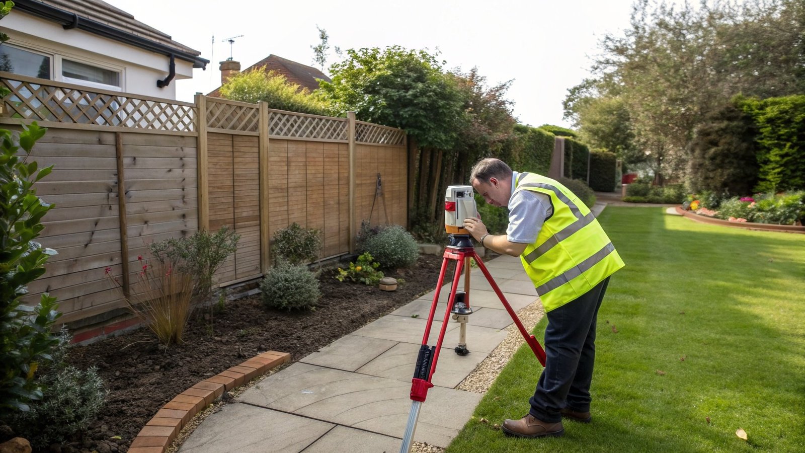
Our experienced surveyors use laser technology and total stations to document everything on the property:
- Underground structures: Old septic tanks, wells, or foundations visible as surface depressions
- Retaining walls: Walls holding back soil that may need maintenance or rebuilding
- Shared infrastructure: Drainage systems or structures that serve multiple properties
- Easements and rights of way: Physical evidence of access rights across the property
- Historical features: Old boundaries, structures, or land uses visible in the topography
When Property Buyers Should Commission Topographic Surveys
Timing is important when commissioning a topographic survey for property purchase. My Topographic Surveyor UK recommends these strategic approaches for property buyers:
Before Making an Offer
For properties where you're planning significant development work or the property has obvious land issues, commission a topographic survey before making your offer. The survey gives you accurate information to base your offer on and demonstrates to sellers you're a serious buyer.
During Survey Period (Subject to Survey)
Most property buyers commission topographic surveys during the survey period after making an offer subject to survey. This timing protects you - if the survey reveals serious issues, you can renegotiate or withdraw without penalty.
For Development Projects
If you're buying land for development or a property requiring substantial renovation, order your topographic survey early. The survey data is essential for planning applications, and delays in obtaining survey data can set back your entire project timeline.
What to Expect When Commissioning a Topographic Survey
Understanding the survey process helps property buyers plan their purchase timeline. My Topographic Surveyor UK provides experienced land surveyors who make the process straightforward.
The Survey Process for Property Buyers
Step 1: Initial Consultation
Contact our experienced surveyors with property details and your timeline. We'll explain what the survey will cover, costs, and delivery timeframes. Most topographic surveys for residential properties cost between £400-£800 depending on property size and complexity.
Step 2: Site Visit
Our land surveyors visit the property with professional survey equipment including total stations and laser technology. The site visit typically takes 2-4 hours for a standard residential property. We don't need the seller to be present, though access to all areas is helpful.
Step 3: Survey Processing and Analysis
After the site visit, our experienced surveyors process the topographic data and create detailed survey drawings. This typically takes 5-10 working days, though we can expedite for urgent property purchases.
Step 4: Delivery of Survey Drawings
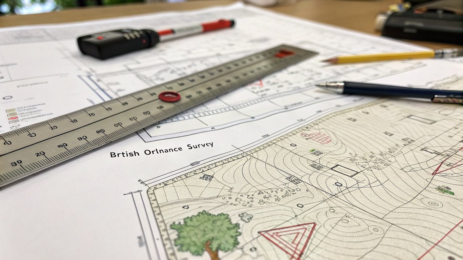
You receive professional CAD survey drawings showing all boundaries, features, contours, and measurements. We include a detailed report explaining what the survey shows and highlighting any issues relevant to property buyers.
Using Topographic Survey Data in Property Negotiations
A topographic survey from My Topographic Surveyor UK gives property buyers powerful negotiating tools. The accurate, impartial survey data can support requests for price reductions or conditions.
How Property Buyers Use Survey Data
- Price adjustments: If the survey reveals boundary encroachment reducing usable land area, buyers can request price reductions based on actual property size
- Seller responsibilities: Buyers can require sellers to resolve boundary disputes or drainage issues before completion
- Contract conditions: Survey findings can be incorporated into purchase contracts, protecting buyers legally
- Insurance evidence: Survey data provides evidence for property insurance and future claims
- Future planning: Accurate survey drawings become valuable references for any work you commission after purchase
The Long-Term Value of Survey Data for Property Owners
A topographic survey commissioned during property purchase continues providing value long after you've moved in. My Topographic Surveyor UK clients regularly return to their survey data years later for various purposes.
Future Uses of Your Topographic Survey
- Planning applications: Survey drawings are required for most planning applications for extensions or outbuildings
- Property improvements: Architects and builders need accurate survey data to design and quote for work
- Boundary disputes: If disputes arise with neighbors, your survey provides compelling evidence of property boundaries
- Property sale: When you eventually sell, existing survey data adds value and speeds up the sale process
- Insurance claims: Survey data provides evidence for property damage or boundary-related insurance claims
FAQs: Topographic Surveys for Property Buyers
How much does a topographic survey cost for property buyers?
Topographic survey costs for residential properties typically range from £400-£800 depending on property size, location, and complexity. My Topographic Surveyor UK provides free quotes with no obligation. The investment is small compared to property purchase costs and can reveal issues worth thousands of pounds.
How long does it take to complete a topographic survey?
The site visit typically takes 2-4 hours for residential properties. Processing and delivery of survey drawings takes 5-10 working days. My Topographic Surveyor UK offers expedited services for urgent property purchases. Total turnaround from booking to receiving drawings is usually 7-14 days.
Do I need the seller's permission to commission a topographic survey?
Yes, you need access to the property for our surveyors to conduct the survey. Most sellers cooperate when asked politely, as surveys are standard due diligence for property buyers. If sellers refuse access, this may indicate they're hiding problems, which is useful information for buyers.
Is a topographic survey different from a building survey?
Yes, they're completely different. A building survey examines the structure - walls, roof, foundations, damp, etc. A topographic survey maps the land, boundaries, external features, and contours. Property buyers often commission both - the building survey checks the house, while the topographic survey checks the land and boundaries.
Can a topographic survey reveal underground services?
A standard topographic survey shows surface-level utility features (manholes, inspection covers, meter boxes) but doesn't trace underground pipes or cables. For comprehensive underground service mapping, you need a separate utility survey using ground-penetrating radar. My Topographic Surveyor UK offers both services.
Will the survey affect my mortgage application?
Topographic surveys don't affect mortgage applications - they're separate from mortgage valuation surveys. However, if your topographic survey reveals serious boundary disputes or land issues, you should inform your solicitor who may advise your mortgage lender. It's better to discover issues before completion than after.
How accurate are topographic surveys?
My Topographic Surveyor UK uses professional survey equipment including total stations and laser technology that provide millimeter-level accuracy. Our experienced surveyors are trained to RICS standards, ensuring survey data is accurate enough for legal purposes, planning applications, and construction work.
Why Choose My Topographic Surveyor UK for Property Purchase Surveys
Property buyers across the UK trust My Topographic Surveyor UK because we understand what buyers need to know. Our experienced land surveyors have helped thousands of property purchasers make informed decisions.
- Fast turnaround: Survey drawings delivered within 7-14 days, with expedited options available
- Buyer-focused reporting: We highlight issues that matter to property buyers, not just technical data
- Comprehensive coverage: Nationwide service with local surveyors who know regional property issues
- Competitive pricing: Transparent quotes with no hidden fees - you know exactly what you're paying
- Professional standards: RICS-accredited surveyors using professional-grade survey equipment
- Expert support: Our team is available to discuss survey findings and answer questions
Don't take chances with the biggest purchase of your life. Commission a professional topographic survey from My Topographic Surveyor UK and buy with confidence, knowing exactly what land you're getting, what issues exist, and whether your development plans are achievable.
Ready to Commission Your Property Purchase Survey?
Contact My Topographic Surveyor UK today for a free, no-obligation quote. Our experienced surveyors provide fast, accurate topographic surveys that protect property buyers from expensive surprises.
Get Free Survey Quote